Flight Planning & Operations for Pilots & Operators
Real-time weather, route planning, and operational insights to ensure every flight is efficient, compliant, and safe.

Making our SGJ experience the smoothest it can be for our pilots
Thanks for planning your next visit to St. Augustine Airport, the Gateway to Florida’s Historic First Coast. Below is a list of airfield information that may be useful when operating into or out of SGJ – St. Augustine Airport.
-

Courtney K. Pittman
Executive Director
-
Address
4796 US 1 North, St. Augustine, FL 32095
-
Phone
904.209.0090

Our Runways
The airport configuration consists of a larger primary runway (8,001 feet) intersected by two smaller runways.
A complex taxiway system provides access to the FBO, businesses, terminals, and hangars, predominantly located on the south and west side of the airport. This video prepares pilots for hot spots and other challenges including the close proximity of the approach ends of runway 2 and runway 6 at SGJ.
-
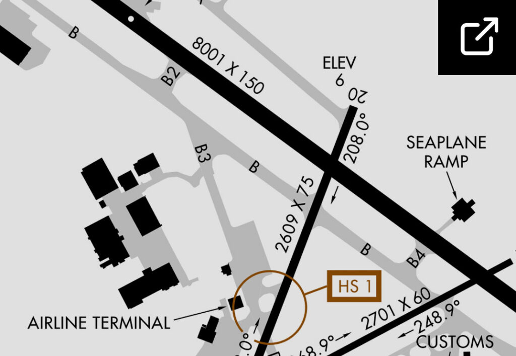 Runway Diagram
Runway Diagram
-
Runway Overview Video
Need additional info before you fly?
Need additional info before you fly?
Our Frequencies & Nav Info
A complex taxiway system provides access to the FBO, businesses, terminals, and hangars, predominantly located on the south and west side of the airport.
Airport Communications Frequencies:
ILS - Cat I:
111.1 MHz
ATIS:
119.625 MHz
AWOS:
119.625 MHz
FSS:
Gainesville (GNV)
Ground Control:
121.175 MHz / 251.125 MHz
Control Tower:
127.625 MHz / 269.475 MHz
APP CTRL JAX:
120.75 MHz
Unicom:
122.95 MHz
CTAF:
127.625 MHz
PCL (Lighting):
127.625 MHz
Atlantic Aviation (FBO):
130.05 MHz
Navigation:
Elevation:
10 ft.
Latitude:
29-5-56.1N
Longitude:
81-20-34.1W
Location:
4 miles N of St. Augustine
Instr Approaches:
ILS, RNAV, GPS
Runway(s):
02/20, 2,609x75, Asph, MIRL
Runway(s):
06/24, 2701x75, Asph, MIRL
Runway(s):
13/31, 8001x150, Asph, HIRL